UrbanStat Expands Wildfire Risk Coverage to New Geographies
UrbanStat, a leading provider of underwriting solutions for P&C insurance companies, has expanded its proprietary wildfire risk maps' coverage to 4 more states. UrbanStat Wildfire Risk Map now covers California, Nevada, Arizona, Washington, and Oregon.
UrbanStat platform offers wildfire risk maps via different organizations covering the entire US, Canada and Europe. However, over the years, we started to see that these generalized models didn't perform well in certain geographies where the wildfires have different characteristics, frequency, and severity.
In 2019, we released our very first version of Wildfire Risk Map for California. Our model has predicted over 90% of the areas that were burned by the most destructive wildfires in 2019 as High or worse risk before the wildfire season started. This very same model performed similarly against the most destructive wildfires that occurred in 2020.
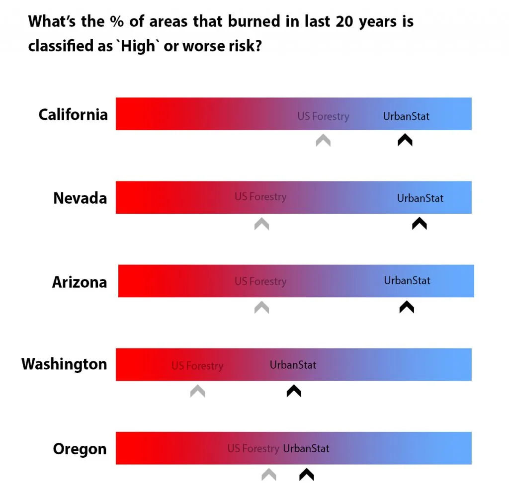
From a long term perspective (e.g. last 20 years), our model has performed 50% better than the US Forestry's model.
In every state, the UrbanStat model has performed better than the US Forestry's wildfire hazard map. In Arizona, Nevada, and Washington, the UrbanStat model has doubled the performance of US Forestry. For example, in Nevada and Arizona US Forestry classified about 42% of the areas that burned as High or worse risk while the UrbanStat model has classified 84% and 81% respectively.
Similar to our California model, we have utilized over 30 different variables to create this model including characteristics such as solar radiation, lightning strikes, hydrology, wind characteristics, transmission network etc. apart from the usual variables such as slope, access, and fuel.
When we first built the wildfire risk model for California, we were surprised by the fact that none of the major variables that are commonly used by other risk map providers was on top 5 in the most important variables list. This has not changed in our newest release, where the most important features are about temperature, lightning strikes, solar radiation, and rainfalls as opposed to slope, access, and fuel.
Every day without better risk models, you're leaving premium on the table.
Stop losing business.
Request a Demo →